Metadata 11
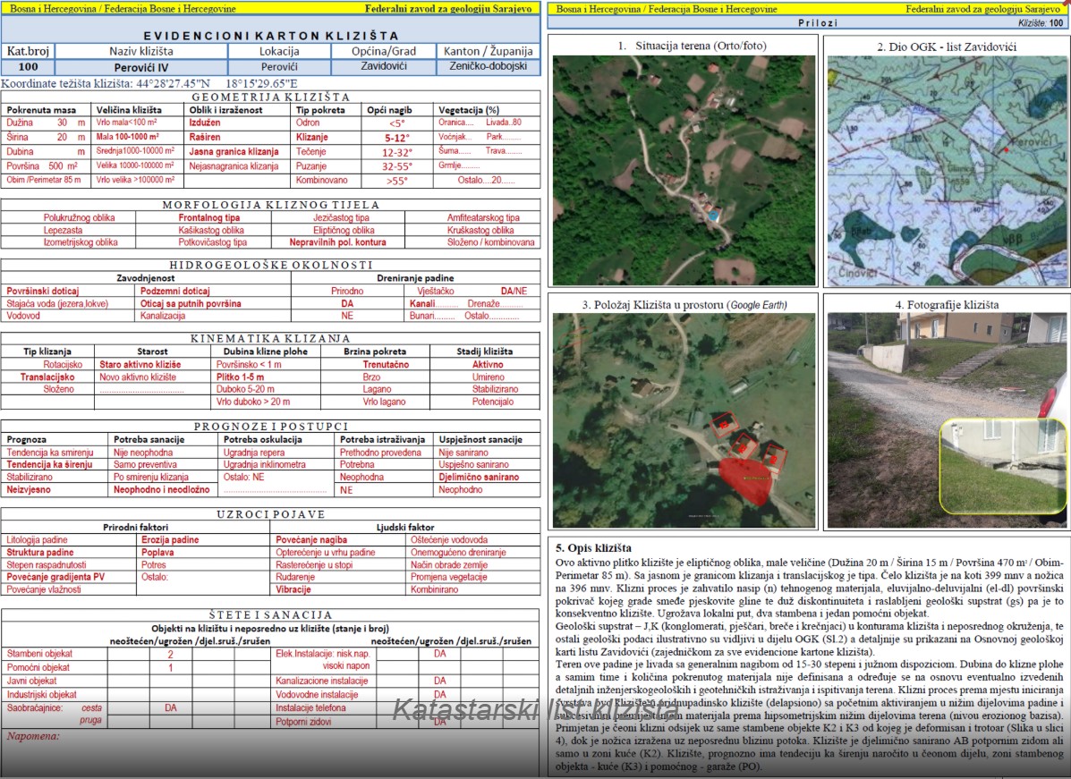 The Cadastre of Landslides of the Federation of Bosnia and Herzegovina represents a central database of registered landslides within the territory of the Federation of BiH. The cadastre is maintained and regularly updated by the Federal Institute for Geology, based on field investigations carried out in cooperation with the competent institutions. It contains information on the location, spatial extent, type, and dynamics of landslides, as well as risk assessment data. The objective of the cadastre is to m...
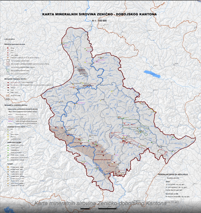 The Cadastre of Mineral Resources of the Federation of Bosnia and Herzegovina includes solid mineral resources whose reserves are determined, classified, and recorded into categories and classes.Energy and nuclear mineral resources: peat, lignite, brown coal, hard coal, oil (bituminous) shale, and uranium.Mineral resources from which metals and their usable compounds can be produced: copper, lead and zinc, mercury, antimony, red bauxite, iron, manganese, nickel, cobalt, chromium, gold, tungsten, molybdenum...
 The Cadastre of Mineral, Thermal, and Thermomineral Waters is a register containing data on all known sources of these waters. Mineral waters have a high content of minerals and other dissolved substances. The cadastre records their geographical location, chemical composition, flow rate, and other characteristics. Thermal waters are those that emerge from deep layers of the Earth and have a higher temperature than the average ambient temperature. The cadastre for thermal waters documents their temperature ...


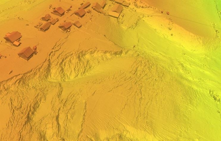 The model provides a detailed representation of the spatial morphology of the terrain and the characteristics of the area affected by the landslide. The data enable the analysis of the landslide geometry, extent, and morphological features, as well as the monitoring of spatial changes. The resource is intended for geological and geotechnical research, landslide hazard and risk assessment, planning of remediation activities, and supporting spatial management and expert decision-making.
 The Engineering Geological Map of Bosnia and Herzegovina is characterized by a pronounced variety in lithostratigraphic composition (rocks and rock complexes are often tectonically heavily damaged), a high degree of seismic activity, complex hydrogeological properties, pronounced relief, varying climate, and steeply inclined watercourses, as well as significant anthropogenic impacts on the terrain. These specific characteristics largely determine the engineering-geological properties of the terrain. Based ...
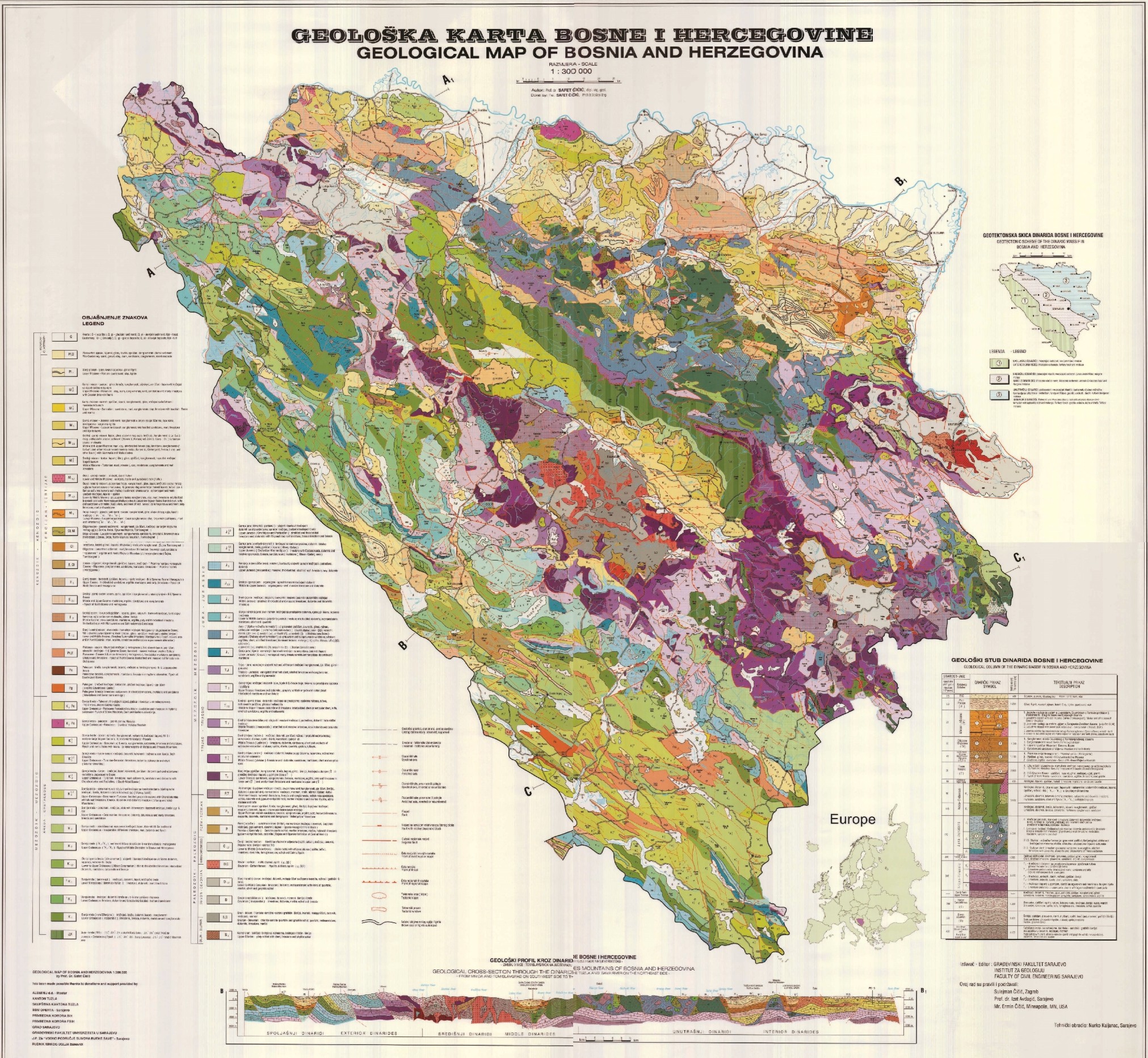 Geological Map represents a summary of the geological composition and tectonics of Bosnia and Herzegovina at a scale of 1:300,000. It outlines the stratigraphy of the Phanerozoic (from Silurian through to Mesozoic and Cenozoic) along with tectonics and geological evolution. It encompasses virtually all existing knowledge about the lithofacies development, thickness, and distribution of geological elements that constitute the geological composition of Bosnia and Herzegovina. It is primarily based on the Bas...
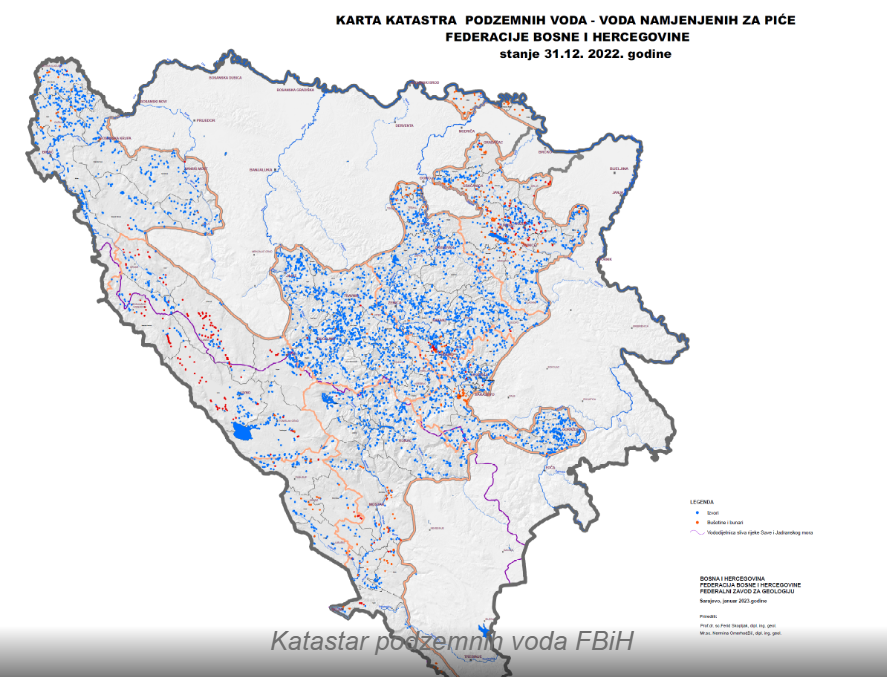 The Groundwater Register of the Federation of Bosnia and Herzegovina is a comprehensive document that includes cadastral sheets of groundwater sources and facilities, a catalog of groundwater sources and facilities, a groundwater map, and an explanatory note for the groundwater map. The cadastral sheets of groundwater sources and facilities provide basic information on the geological and hydrogeological characteristics of aquifers, including the distribution and characteristics of sources and facilities, y...
 The Hydrogeological Map of Bosnia and Herzegovina is a specific type of thematic map that illustrates the quantity, composition, chemical properties, location, dimensions, geological characteristics, features, and phenomena of groundwater. According to its scale, the mentioned Hydrogeological Map (HGK) falls into the category of medium-scale maps, i.e., 1:500,000, and is classified as an overview map. To better depict relationships on a map of this scale, special attention was given to the hydrogeological ...
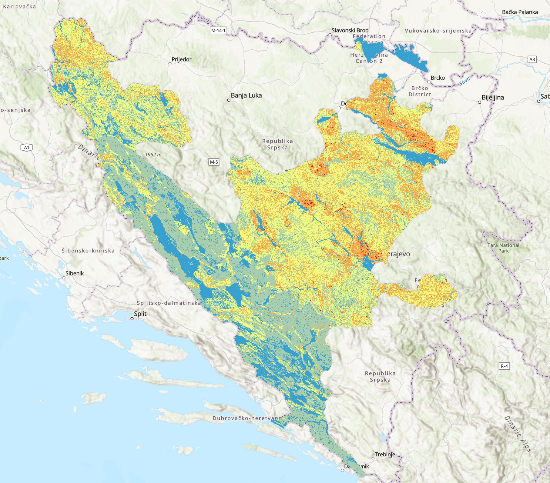 The Landslide Susceptibility Map of the Federation of Bosnia and Herzegovina depicts areas according to their level of landslide risk. The map was developed through the integration of various data sources, including a Digital Elevation Model (DEM), land use data from the CORINE Land Cover (CLC) database, as well as geomorphological, geological, and hydrological factors influencing landslide occurrence. The map serves as a professional basis for risk assessment, planning of protective measures, spatial mana...
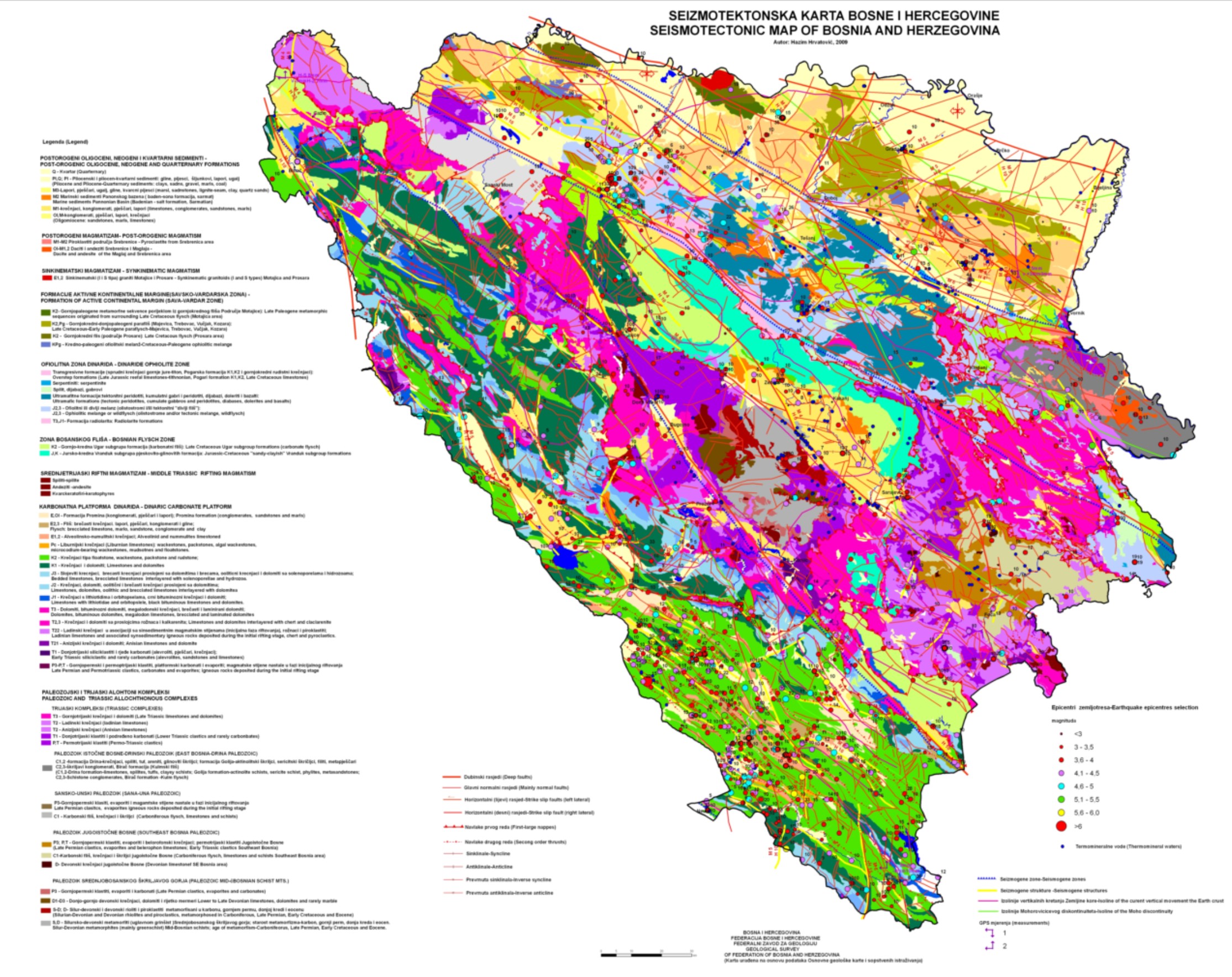 The Seismotectonic Map of Bosnia and Herzegovina is a thematic cartographic representation of the spatial distribution of active faults, seismic zones, and major tectonic structures within the territory of Bosnia and Herzegovina. The map integrates geological, tectonic, and seismological data in order to identify areas of increased seismic activity and to support seismic hazard assessment. The data are based on long-term geological investigations, instrumental and historical earthquake records, and the ana...