Metadata 22
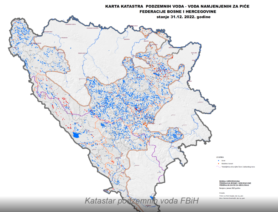 The Groundwater Register of the Federation of Bosnia and Herzegovina is a comprehensive document that includes cadastral sheets of groundwater sources and facilities, a catalog of groundwater sources and facilities, a groundwater map, and an explanatory note for the groundwater map. The cadastral sheets of groundwater sources and facilities provide basic information on the geological and hydrogeological characteristics of aquifers, including the distribution and characteristics of sources and facilities, y...


 The Hydrogeological Map of Bosnia and Herzegovina is a specific type of thematic map that illustrates the quantity, composition, chemical properties, location, dimensions, geological characteristics, features, and phenomena of groundwater. According to its scale, the mentioned Hydrogeological Map (HGK) falls into the category of medium-scale maps, i.e., 1:500,000, and is classified as an overview map. To better depict relationships on a map of this scale, special attention was given to the hydrogeological ...
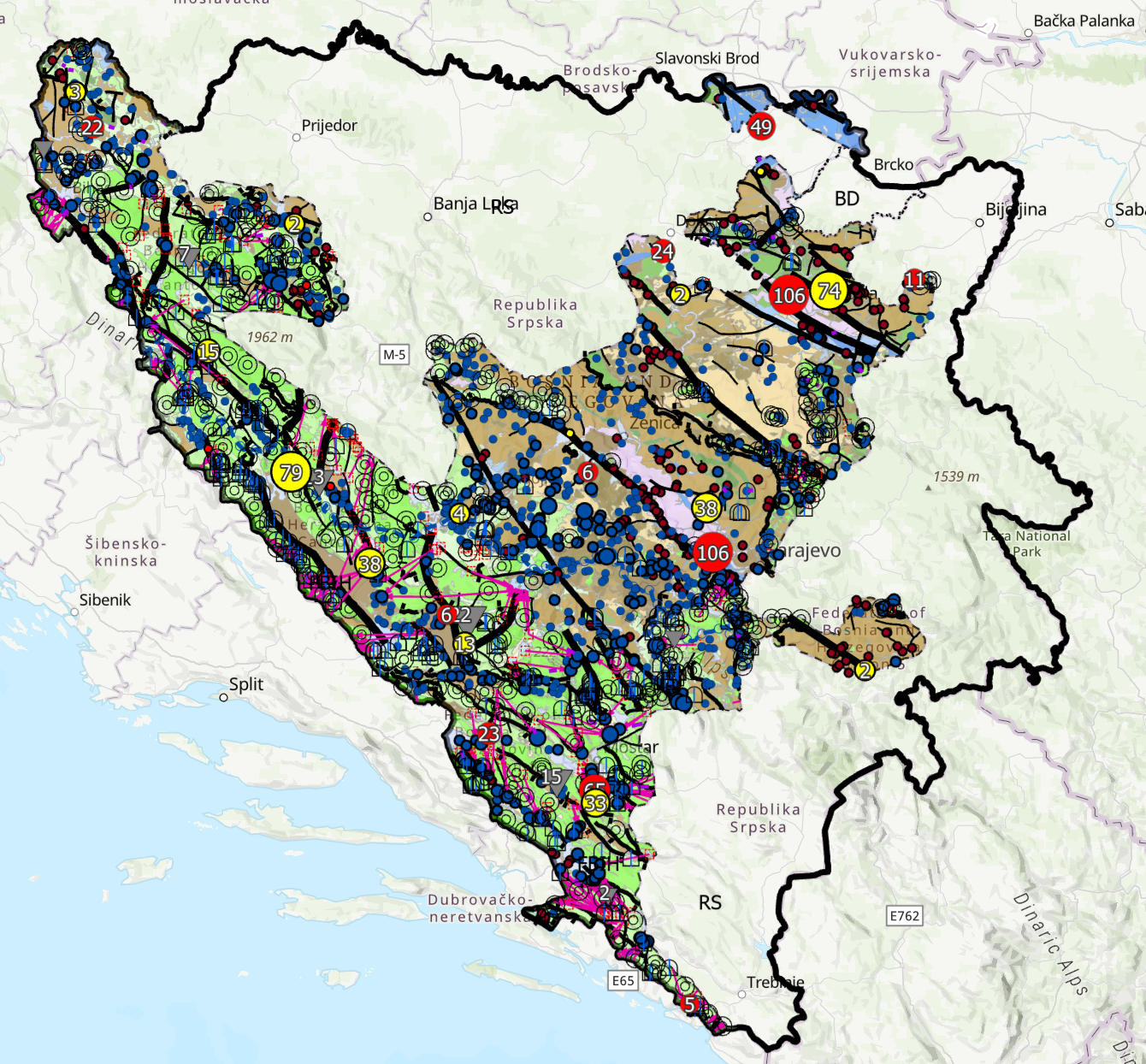 The Hydrogeological Map of the Federation of Bosnia and Herzegovina at a scale of 1:100,000 presents the main hydrogeological characteristics of the territory of the Federation of Bosnia and Herzegovina. The map depicts hydrogeological units, their main hydrogeological characteristics, aquifer types, groundwater occurrences, and other relevant hydrogeological features. The data provide an overview of the spatial distribution of hydrogeological properties and serve as a basic reference for hydrogeological i...
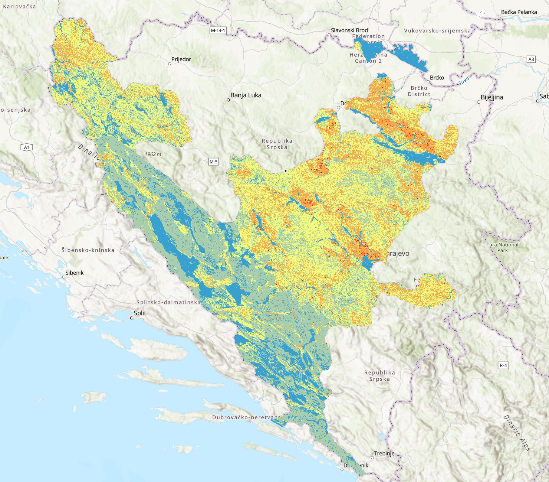 The Landslide Susceptibility Map of the Federation of Bosnia and Herzegovina depicts areas according to their level of landslide risk. The map was developed through the integration of various data sources, including a Digital Elevation Model (DEM), land use data from the CORINE Land Cover (CLC) database, as well as geomorphological, geological, and hydrological factors influencing landslide occurrence. The map serves as a professional basis for risk assessment, planning of protective measures, spatial mana...
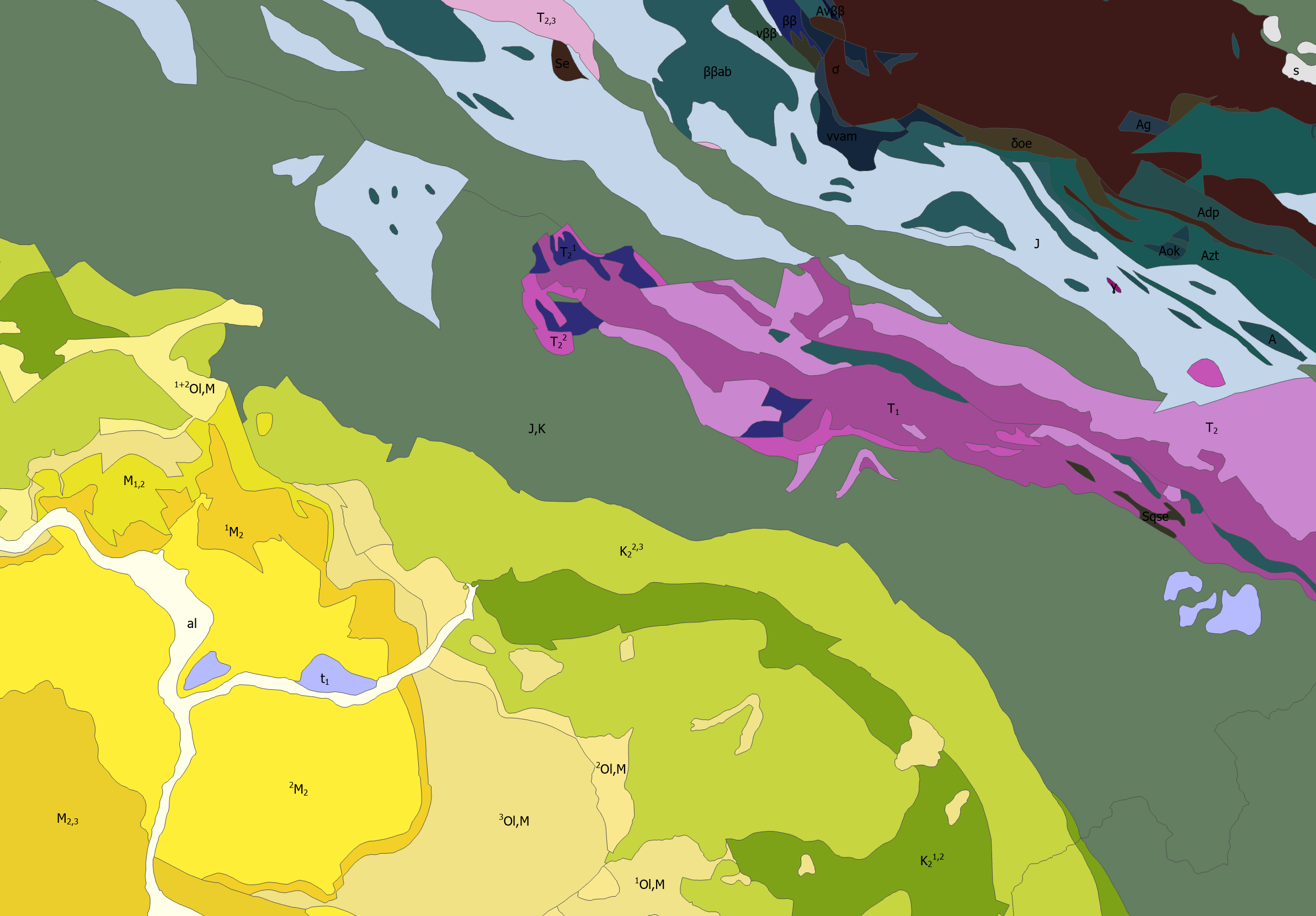 Lithostratigraphic units are vectorized polygon data derived from the Basic Geological Map of Bosnia and Herzegovina at a scale of 1:100.000 (BGM 1:100.000). The layer shows the spatial distribution and boundaries of lithostratigraphic units across the territory of Bosnia and Herzegovina, together with their basic geological characteristics and associated attribute data.
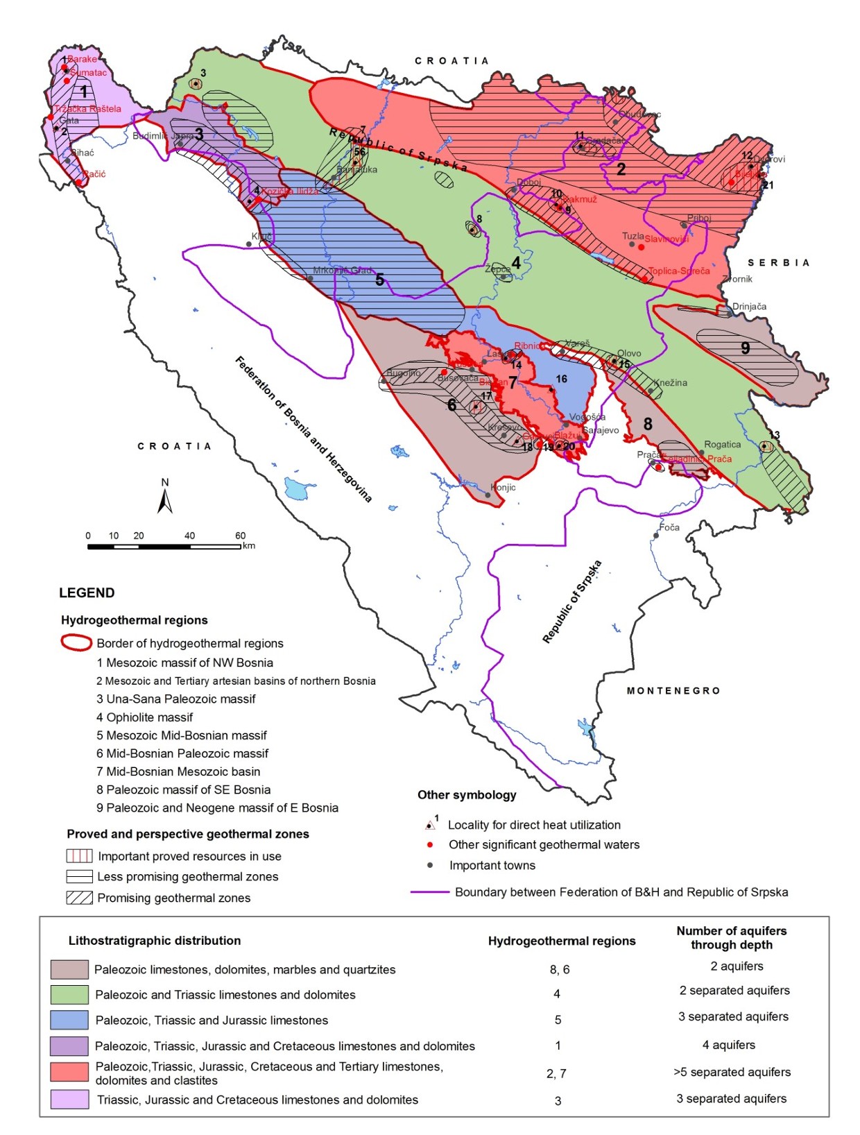 This document provides an overview of geothermal energy research, development, and utilization in Bosnia and Herzegovina during the period 2010–2014. It presents the distribution of hydrogeothermal regions, geothermal reservoirs, principal aquifers, the energy potential of geothermal resources, and their level of utilization. The document also includes information on the direct use of geothermal energy in spas, building heating, and ground-source heat pump systems, as well as an overview of the most signif...
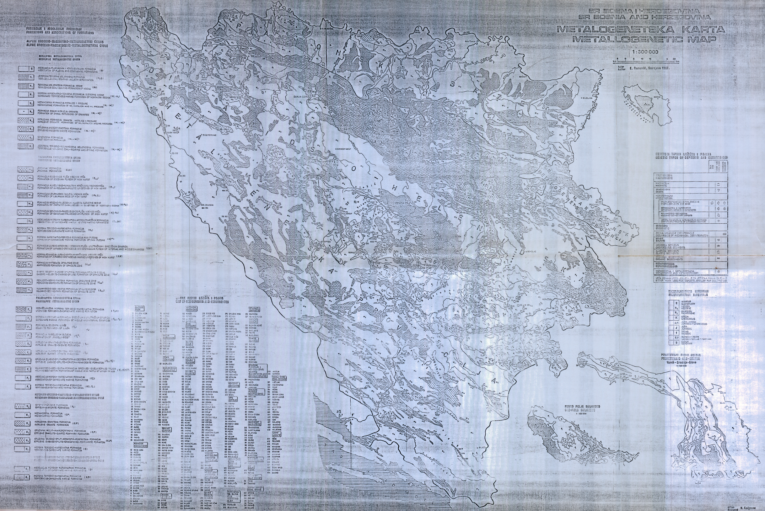 The Metallogenetic Map of Bosnia and Herzegovina at a scale of 1:300,000 provides an overview of the spatial distribution of metallogenetic and mineralogenetic units, mineral occurrences, and mineral deposits across the territory of Bosnia and Herzegovina. The map illustrates the spatial relationship between mineralization and geological structure, lithological composition, tectonic structures, and other geological factors significant for the formation and spatial distribution of mineral resources. The dat...
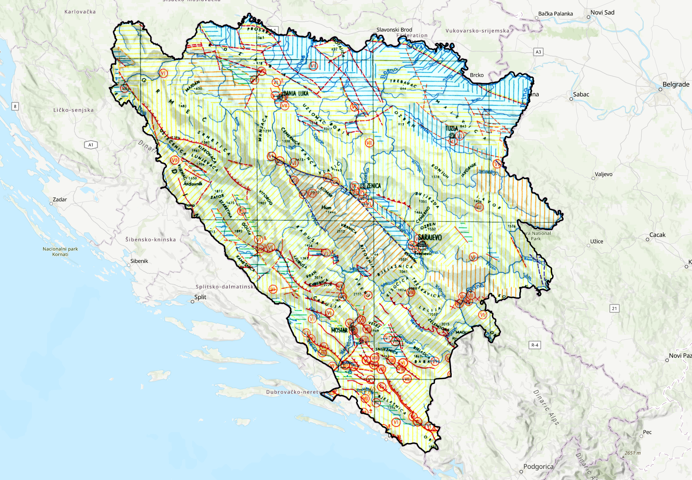 The Neotectonic Map of Bosnia and Herzegovina at a scale of 1:1,500,000 presents the main characteristics of neotectonic activity and the tectonic structure of the territory of Bosnia and Herzegovina. The map was prepared as part of the Neotectonic Map of the Socialist Federal Republic of Yugoslavia. It shows areas of uplift and subsidence, significant neotectonic dislocations, including faults and thrusts, as well as relevant seismological data. The map provides an overview of the spatial relationships be...
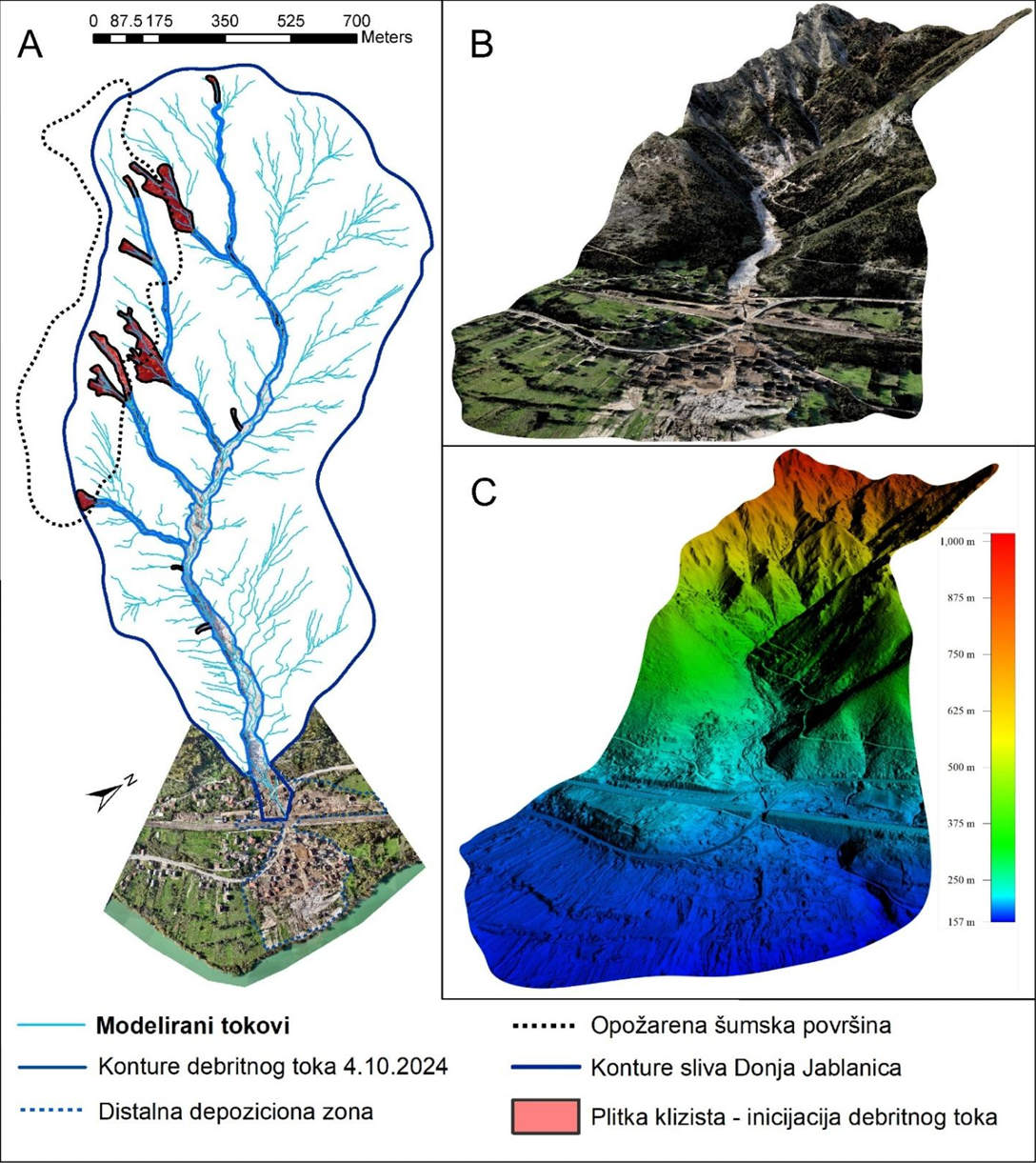 The report presents an integrated analysis of geological, hydrogeological, engineering-geological and geomorphological processes triggered by floods and landslides in the Federation of Bosnia and Herzegovina. It covers the areas of Jablanica, Konjic, Fojnica, Kiseljak and Kreševo, with particular focus on debris flows, landslides, erosion processes, terrain stability and the condition of drinking water springs. The report includes hazard and risk assessment, risk zoning, a landslide susceptibility map, the...
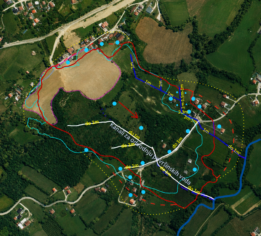 The report provides an overview of the engineering-geological characteristics and the current condition of the terrain at the “Mladoševica” landslide site in Maglaj. It includes data on the geological structure of the terrain, the characteristics and spatial extent of the landslide, the causes and conditions leading to its reactivation, as well as the conditions observed during field inspections conducted in January 2025.The “Mladoševica” landslide is an old detrital landslide, documented and investigated ...