Landslide Susceptibility Map of the Federation of Bosnia and Herzegovina


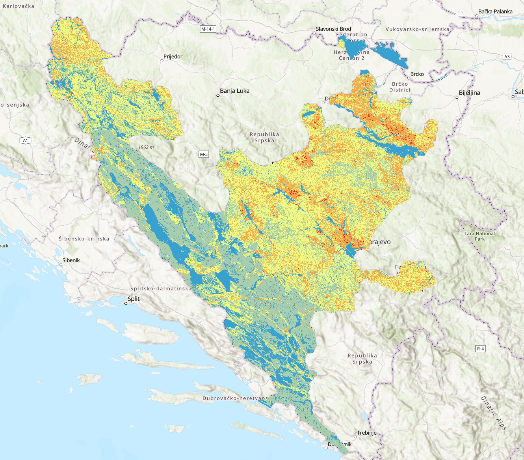
The Landslide Susceptibility Map of the Federation of Bosnia and Herzegovina depicts areas according to their level of landslide risk. The map was developed through the integration of various data sources, including a Digital Elevation Model (DEM), land use data from the CORINE Land Cover (CLC) database, as well as geomorphological, geological, and hydrological factors influencing landslide occurrence. The map serves as a professional basis for risk assessment, planning of protective measures, spatial management, and for scientific research and educational purposes.
dataset
Bosnian, English
Environment
GEMET - INSPIRE themes, version 1.0:

 Spatial scope:
GeoERA Keyword Thesaurus:
FZZG Geoscientific themes:
Spatial scope:
GeoERA Keyword Thesaurus:
FZZG Geoscientific themes:
Free:
landslides
map
susceptibility
15.729,
42.555,
19.624,
45.276
creation: 2024
2024
-
now
vector
The Landslide Susceptibility Map was developed to identify and spatially represent areas within the Federation of Bosnia and Herzegovina according to different levels of landslide risk. The map serves as a professional basis for risk assessment, planning of preventive and protective measures, spatial management, support in planning and project decision-making, as well as for scientific research and educational purposes.
Geological Survey of the FBiH
Vedad Demir
Ustanička 11,
Ilidža, Sarajevo,
71210,
Bosna i Hercegovina
tel: +38733483365
email:
vedad.demir@fzzg.gov.ba
Role: author
Data Quality
The landslide susceptibility analysis was conducted using a 10 m resolution Digital Elevation Model (DEM), the Geological Map of the Republic (OGK) at a scale of 1:100,000, and land use data from the 2018 CORINE Land Cover (CLC) database. The data were processed and integrated in a GIS environment to produce the susceptibility map, with verification of spatial and attribute consistency, and harmonization with the applicable technical standards of the Federal Institute for Geology.
Equivalent Scale:
1:
100.000
Constraints
Use and access to data in accordance with the applicable regulations and practices of the Geological survey of Federation of Bosnia and Herzegovina.
Vector data have restricted use and are provided upon request.
Metadata about metadata
69a18dcb-2c48-4a1f-a010-15d540a010e92
Geological Survey of the FBiH
Maida Zejnic
Ustanička 11,
Ilidža, Sarajevo,
71210,
Bosna i Hercegovina
tel: +38733483368
email:
maida.zejnic@fzzg.gov.ba
Role: point of contact
2026-02-27