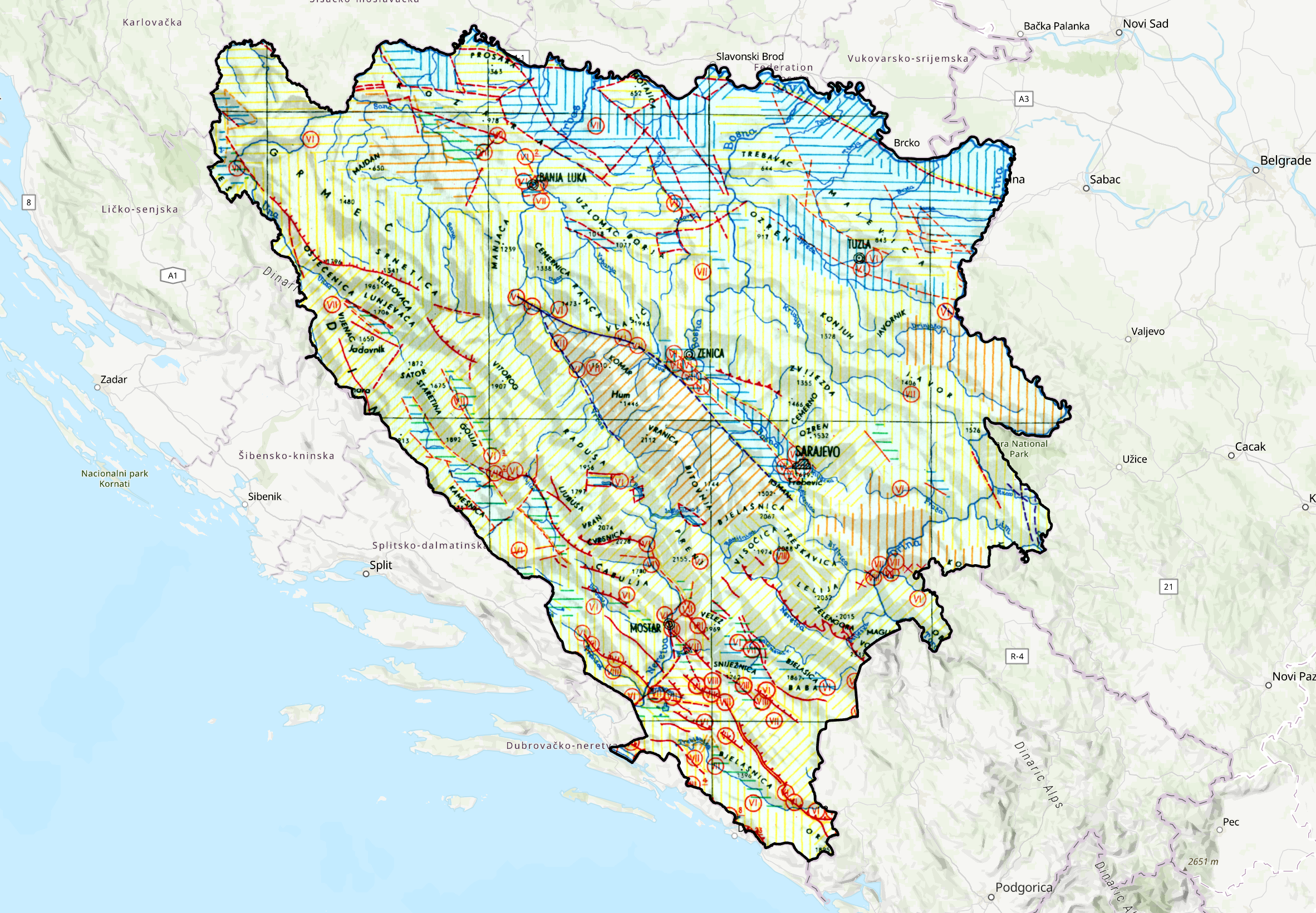
Neotectonic Map of Bosnia and Herzegovina


The Neotectonic Map of Bosnia and Herzegovina at a scale of 1:1,500,000 presents the main characteristics of neotectonic activity and the tectonic structure of the territory of Bosnia and Herzegovina. The map was prepared as part of the Neotectonic Map of the Socialist Federal Republic of Yugoslavia. It shows areas of uplift and subsidence, significant neotectonic dislocations, including faults and thrusts, as well as relevant seismological data. The map provides an overview of the spatial relationships between neotectonic structures and areas of different vertical movements and serves as a basis for studying neotectonic activity, tectonic structure, and seismicity of the territory of Bosnia and Herzegovina.
skup podataka
Bosanski, Engleski, Srpski
Geonaučne informacije

15.729,
42.555,
19.624,
45.276
publikacija: 1967
završeno
grid
The map is intended to provide an overview and support the study of the main neotectonic characteristics, tectonic structures, areas of uplift and subsidence, and seismicity of the territory of Bosnia and Herzegovina. It can be used as a scientific and professional basis for geological and tectonic research, spatial planning, assessment of geological and seismic conditions, and other activities related to the study of the geological structure and neotectonic activity.
Vedad Demir
Ustanička 11,
Ilidža, Sarajevo,
71210,
Bosna i Hercegovina
tel: +38733483365
email:
vedad.demir@fzzg.gov.ba
Uloga: čuvar
Kvalitet podataka
The Neotectonic Map of Bosnia and Herzegovina at a scale of 1:1,500,000 was prepared in 1967 by Branislav Ćirić. The map was compiled based on the Neotectonic Map of the Socialist Federal Republic of Yugoslavia and represents a cartographic overview of the main neotectonic characteristics and tectonic structures of the territory of Bosnia and Herzegovina.
Ograničenja
Use and access to data in accordance with the applicable regulations and practices of the Geological Survey of the Federation.
Metapodaci o metapodacima
6aa299fe-f264-4144-ae78-39a180a010e92
Maida Zejnic
Ustanička 11,
Ilidža, Sarajevo,
71210,
Bosna i Hercegovina
tel: +38733483368
email:
maida.zejnic@fzzg.gov.ba
Uloga: kontakt tačka
2026-09-29